a follow-up on drones from George Leopold…
NOAA is moving out smartly on several fronts to help deploy robotic airplanes carrying a variety of meteorological payloads to track hurricanes, monitor national marine sanctuaries and, soon, take the temperature of shrinking Arctic ice.
As discussed in our last post, unmanned aerial vehicles, or UAVs, are emerging as a “gap filler” technology as funding for Earth observation satellites is squeezed and program delays threaten to create coverage gaps for forecasters and climate modelers. While much of the focus has been on high-flying, long-endurance Global Hawks for hurricane tracking, NOAA is also collaborating with other agencies and university researchers to deploy smaller yet capable drones like the hand-launched Puma to monitor U.S. maritime sanctuaries and coastlines.
While it ramps up efforts to again help NASA track hurricanes with a pair of Global Hawk’s, NOAA’s Unmanned Aircraft Systems program is also preparing to help monitor retreating Arctic sea ice as part of the Marginal Ice Zone Observations and Process Experiment. The experiment focuses on targeted observations to gain a better understanding of local conditions like sea surface temperature and salinity during summer melts.
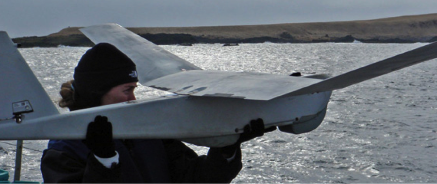
A NOAA researcher prepares to launch a Puma AE drone on a test flight off Hawaii.
Program managers said the experiment “will directly address these information gaps through a targeted, intensive observing campaign that exploits unique capabilities of multiple classes of UAS,” including NASA Ames’ Sierra UAV, the ScanEagle operated by the University of Alaska and small flying sensors operated by the University of Colorado at Boulder called DataHawk.
The key here is that the smaller, low-altitude UAVs can be used to hover over hard-to-reach areas, study the lower atmosphere and even be used to drop sondes into the cracks in melting sea ice.
With a relatively modest $3 million budget, NOAA’s UAS office is gearing up for the Arctic expedition while preparing for the 2013 hurricane season. NOAA program manager Robbie Hood has leveraged collaboration with the U.S. Army to acquire Puma UAVs for about $100,000 each. Given the hand-launched drone’s capabilities and reliability, that’s a bargain.
“Our job is to look at all these new technologies,” Hood stressed, then apply them to a host of new weather and climate observations extending from the Earth’s surface to the tops of hurricanes.
The Puma AE has a 9.2-foot wingspan, weighs 13 pounds and can remain aloft for up to two hours. The wateright drones are recovered after splash landings. The Puma was originally designed to carry payloads like IR sensors mounted on a gimbaled platform to provide 360-degree coverage. Hood said her team is in the process of prioritizing requirements for weather sensor payloads.
UAV skeptics, mostly in the satellite community, argue that their small footprint means they had better be pointed in the right direction when making weather observations. Hand-launching Pumas with increasingly sophisticated navigation aids from U.S. Coast Guard ships, for example, (see photo) would appear to address that problem while at the same time extending the observing range of research ships plying Arctic waters.
Hood also notes there are plenty of experienced UAV operators in the military who could be hired to direct science missions – two birds with one stone, if you will….
So, it turns out that drones are useful for many different kinds of environmental monitoring in remote areas. Those attributes could well trump at least some of the privacy concerns that make many observers uncomfortable with the technology.
-George Leopold


The President’s FY14 budget request includes a $2 million increase in NOAA’s budget for “Unmanned Aircraft Systems to accelerate next generation weather observing platforms.”
The funding request is listed under NOAA’s “Weather & Air Chemistry Research” account (Source: http://osec.doc.gov/bmi/Budget/FY14BIB/ENTIREBIB.pdf, p.86).